Data

Companies have terabytes of data that Asseti transforms into competitive advantage.

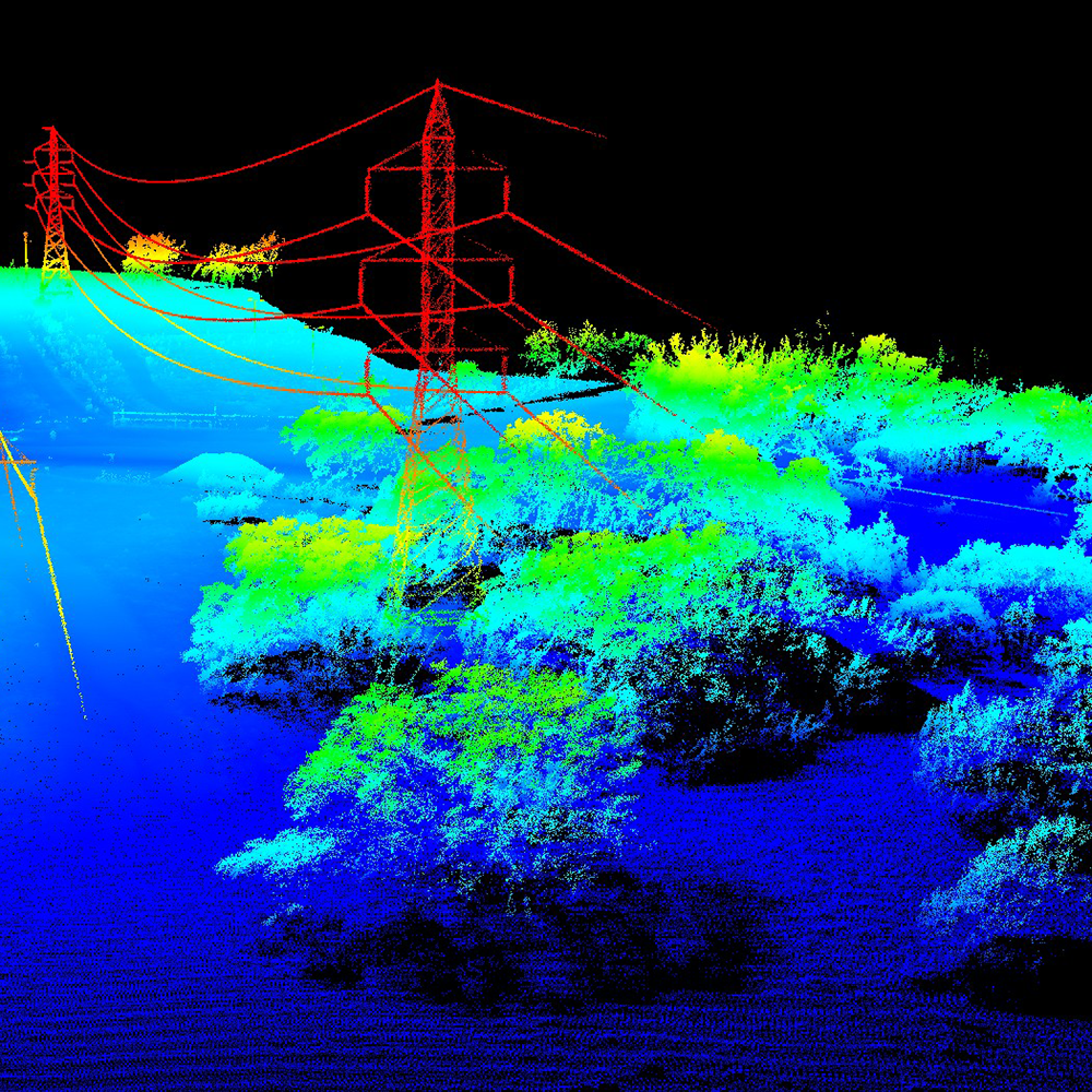
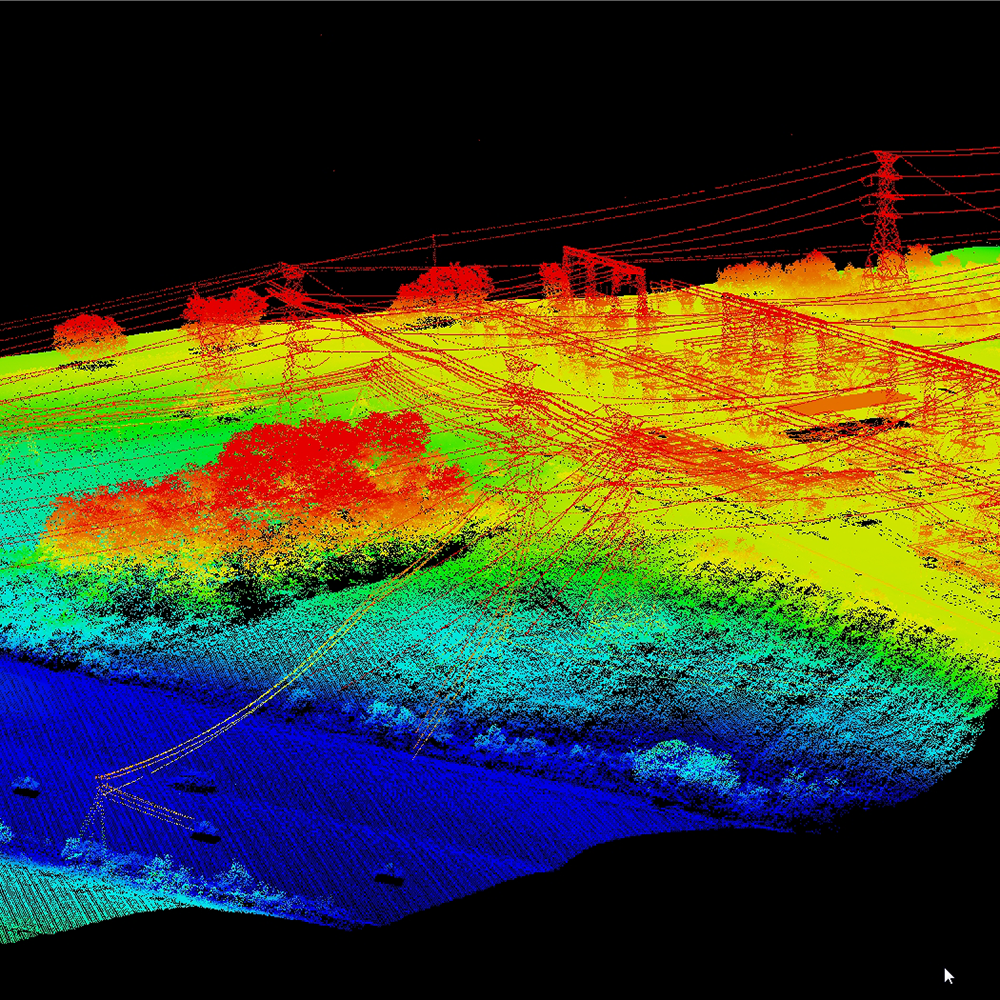
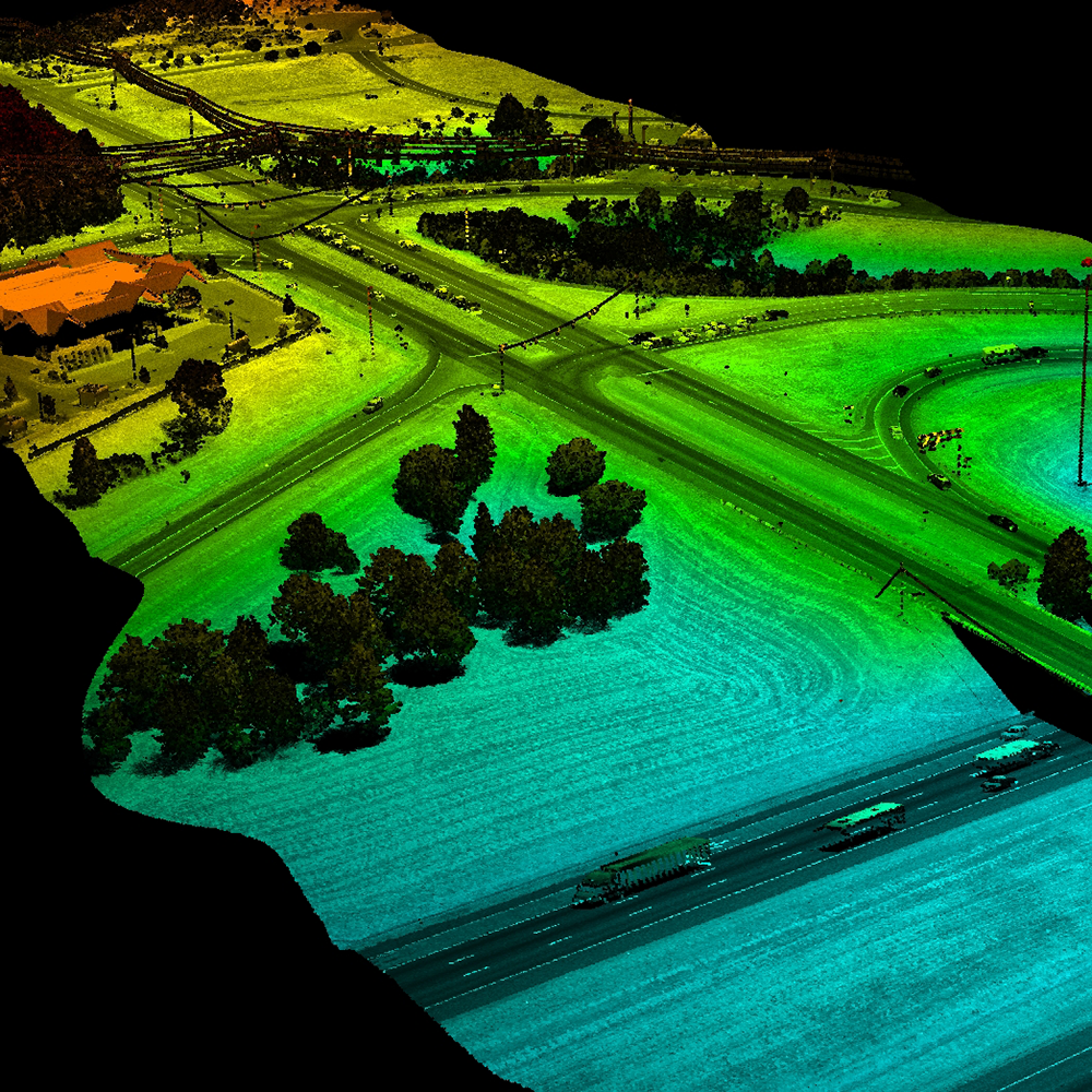
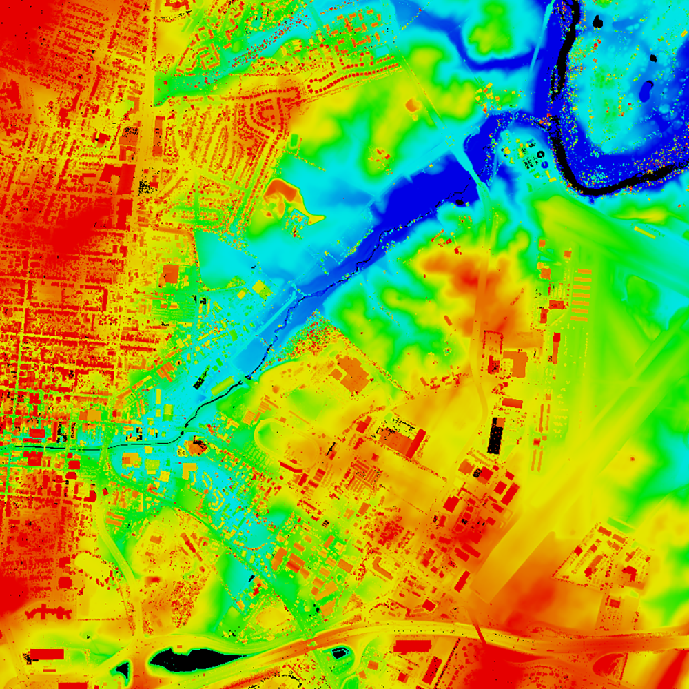
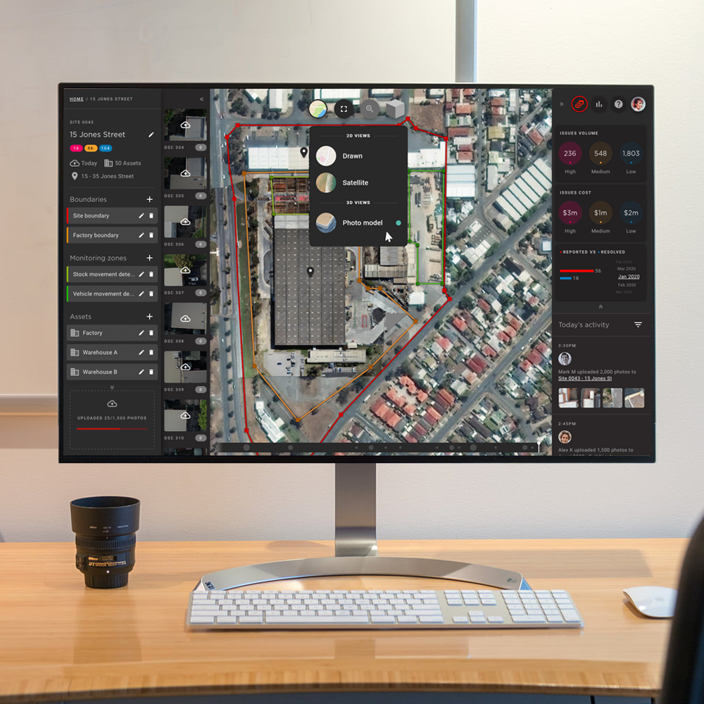
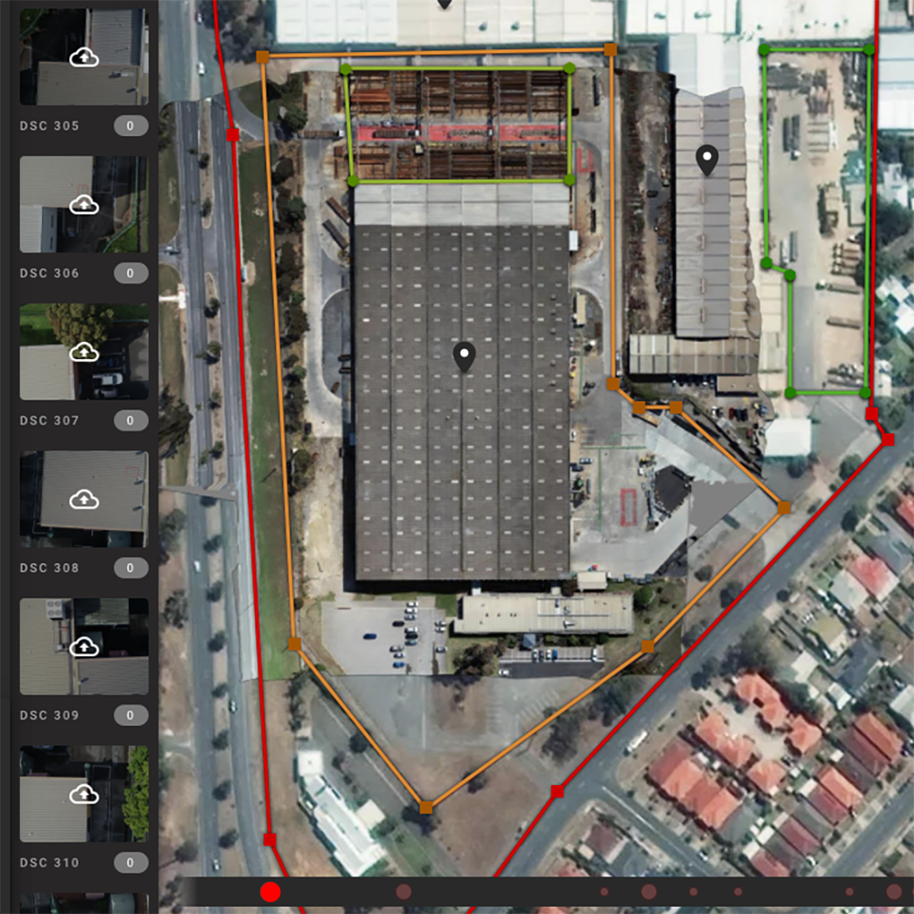
Asseti is a powerful data engine, with the capacity to consume and make sense of vast geospatial datasets. Spatially referenced vector and raster datasets are the most commonly added.

Companies have stored status and action data records for decades, and big data AI/ML-powered systems can interrogate that history to accurately recommend future action.

Vector

Vector data has geospatial coordinates, and the combination of points determine if the dataset represents a point, arc or polygonal information. Vectors in asset management reference locations in which change should be monitored, such as a telegraph pole, power line corridor, building boundary or solar farm envelope.

LiDAR point cloud of electricity infrastructure, power lines
Linear assets including roads, power lines and oil pipelines are ideal for LiDAR mapping
Vector mapping has numerous possible filetypes, Asseti supports a growing number

Raster

Raster data is presented in a grid of pixels carrying values, and can be 2D or 3D. Raster data typically refers to imagery, aerial data and large continuous spatial datasets. 

Raster datasets are invaluable in the asset management world, as they depict defects and change over time – for example, photogrammetry can be used to determine stockpile inventory, and continuous imagery can be used to identify roofing defects and vegetation danger to infrastructure. Asseti is experienced in making raster data enduringly valuable to the data owner.

Method of data capture

GIS ‘data capture’ refers to the method of creating datasets with necessary attributes across location, time and features. Raster data is primarily image-based and captured by a camera or sensor that parses grids of pixels.

Asseti has a partner network to assist in data capture if required. The most common methods are aerial data capture from manned or unmanned vehicles (that is, planes and helicopters versus drones), as well as low orbit capture from satellite, ground-vehicle mounted imaging and fixed point imaging. Asseti is optimised to consume all types of raster data and provide insights to asset managers. 

Temporal context
Coordinate systems
File size, raster compression & zoom
Raster file types
Drone data capture in construction
Asseti delivers value from evidence of change over time
Asseti manages many coordinate options
Asseti uses raw and compressesd files top optimise experience
Asseti accepts most raster filetypes

Multi-temporal

Multi-temporal data is a subset of datasets that incorporates two or more datasets of the same focal area or element. Multi-temporal datasets do not require even time-lapse intervals and can carry independent observations.

Stationary assets such as buildings and pipelines derive change over time insights from multi-temporal datasets, which asset network managers use to plan maintenance and repair operations. Asseti is optimised to understand and serve insights based on condition change over time. 

Asseti enables easy review of change over time
Asseti temporal slider to assist review of change over time

Find out more

as-Toyota-Australia-Altona

Hear what our customers say

Stay in touch with Asseti

Need Help?

Connect via live chat